

This is an easy & FREE to integrate Nearby COVID Places Search (such as Vaccine Centres, Hospitals, Testing Centres, Isolation Centres etc) Widget by MapmyIndia.
Every person can benefit from being able to easily find nearby COVID vaccination centres, hospitals, testing centres etc - see them on a map, get directions, and get more information about them.
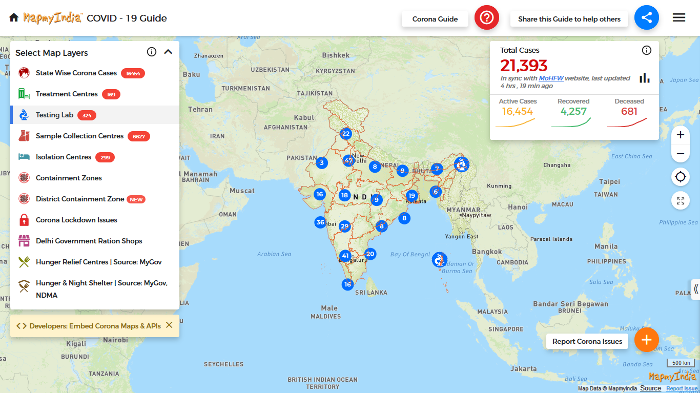
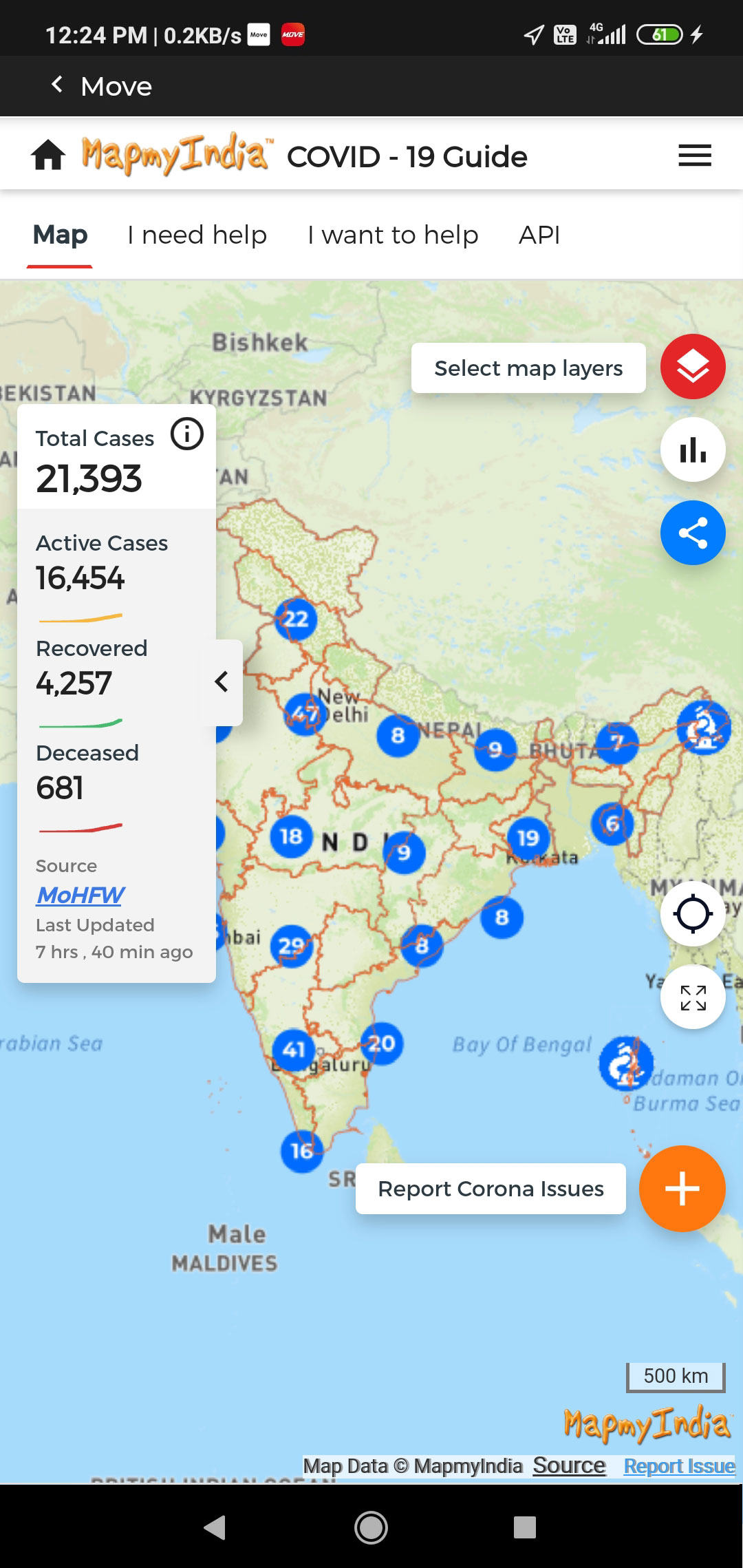
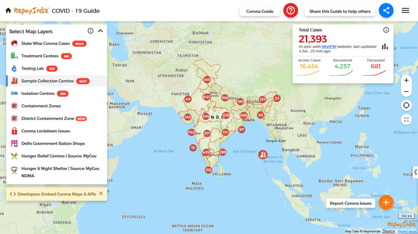
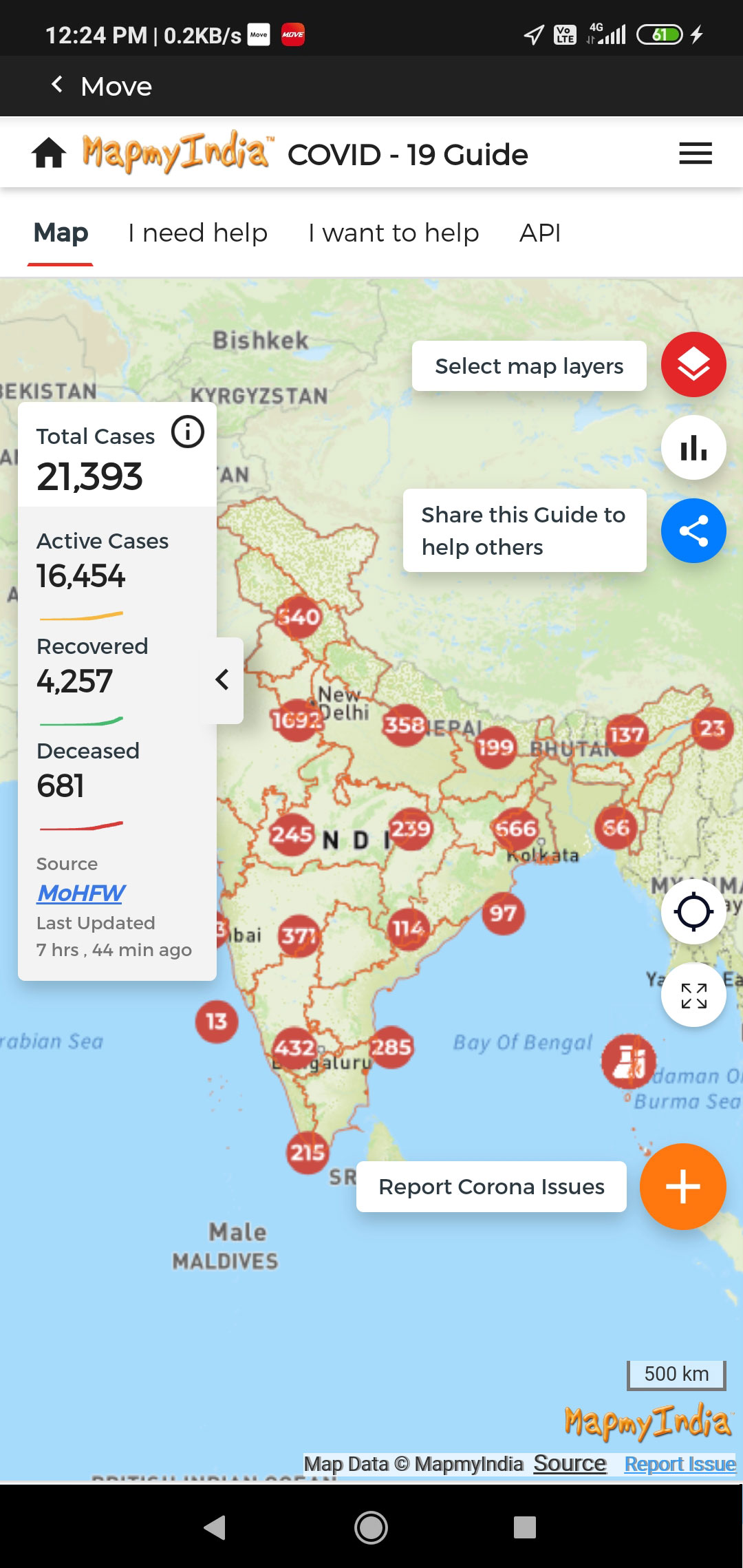
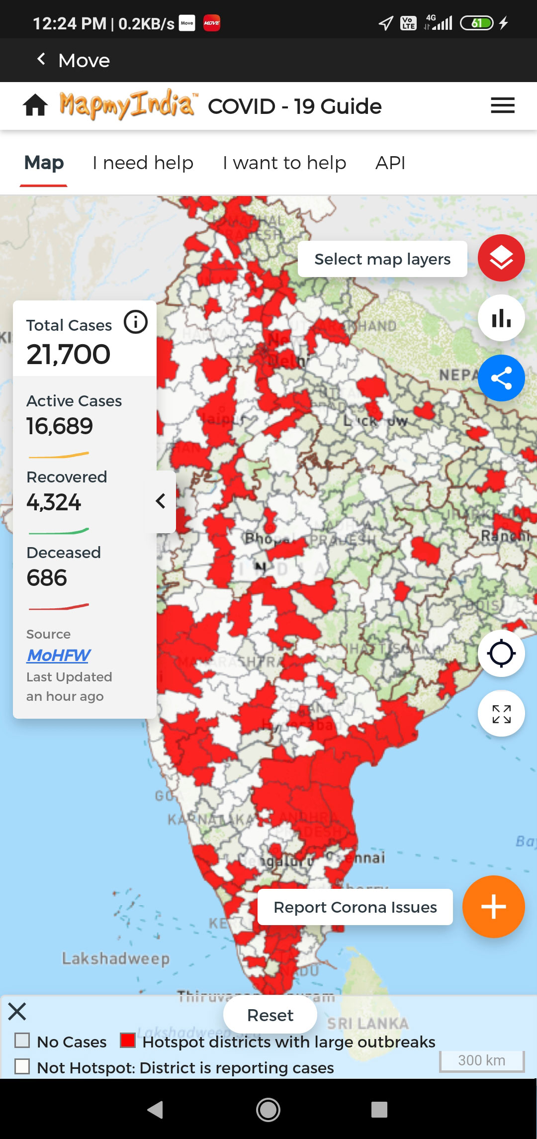
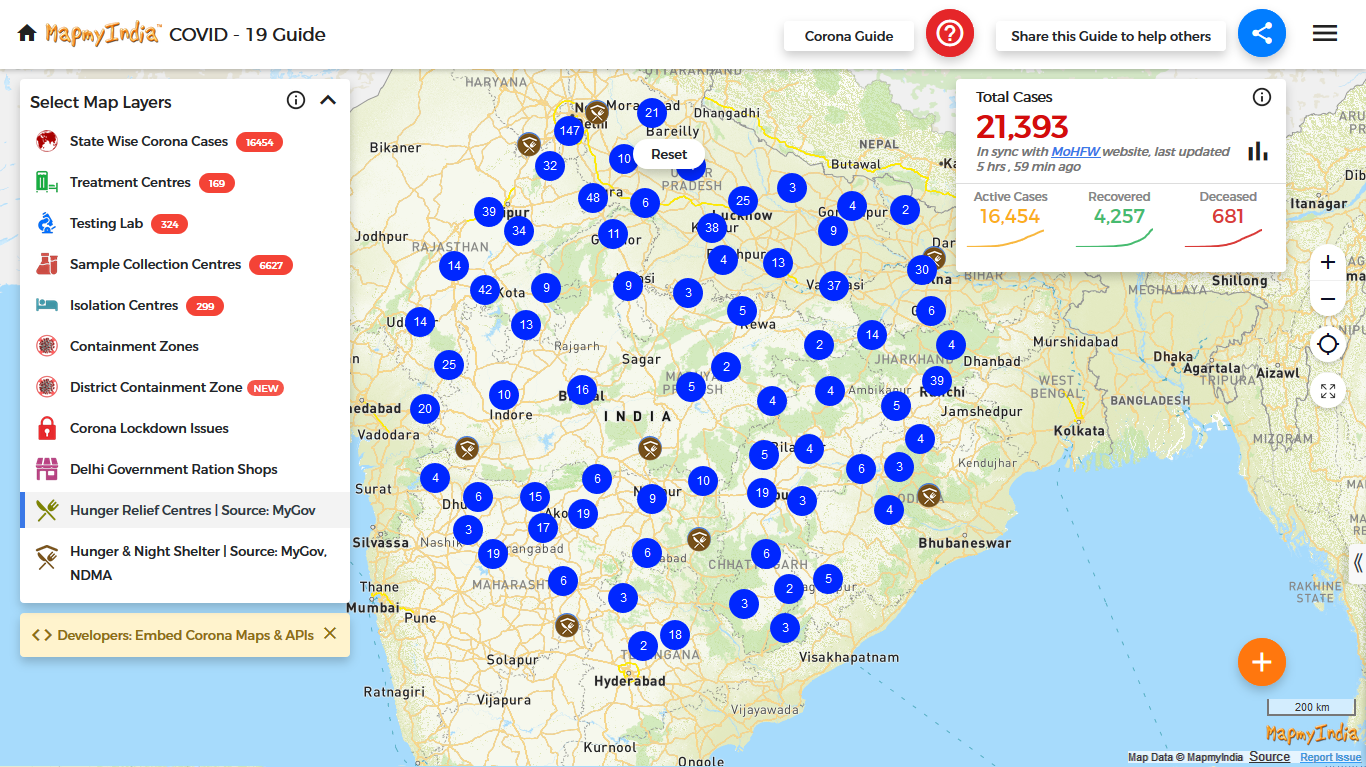
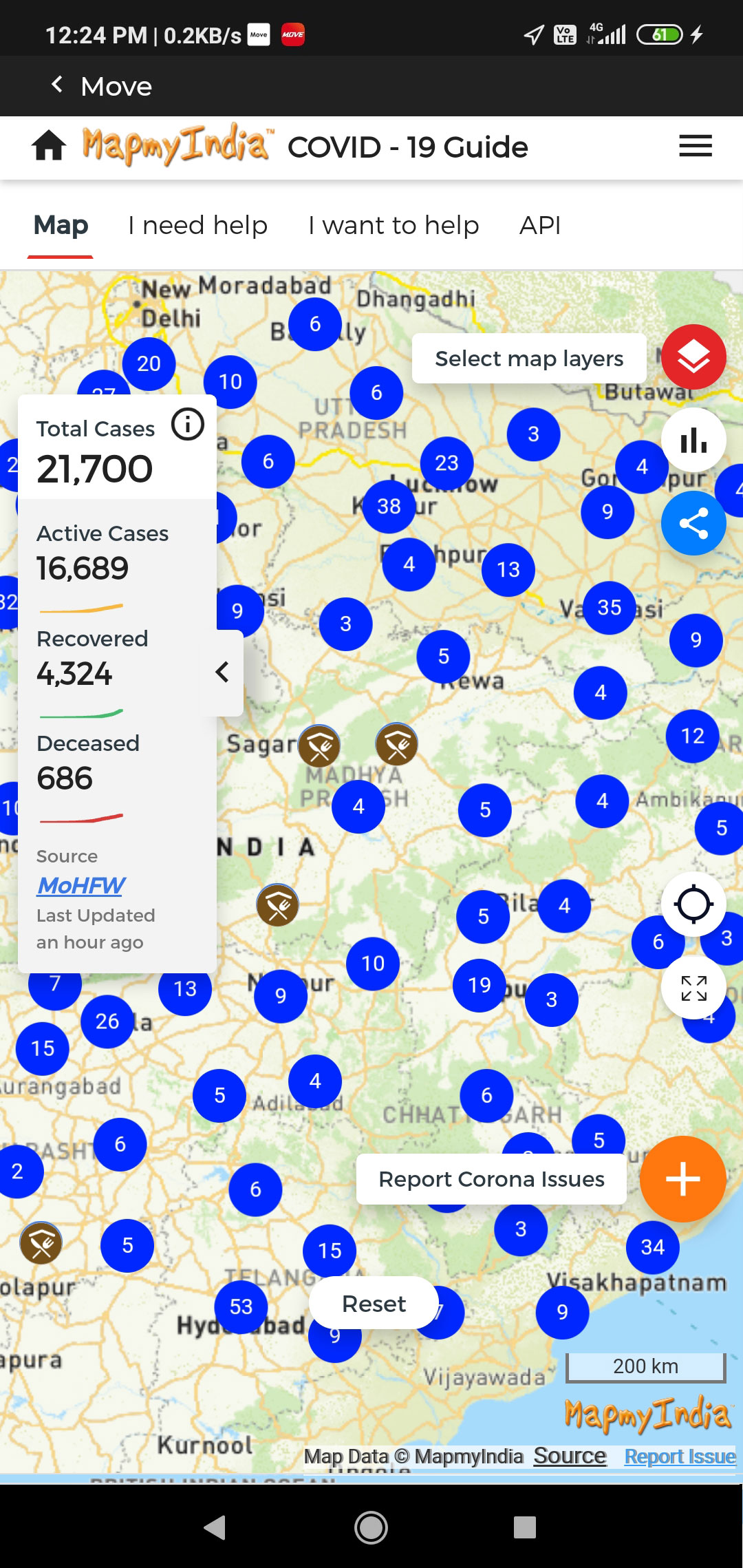
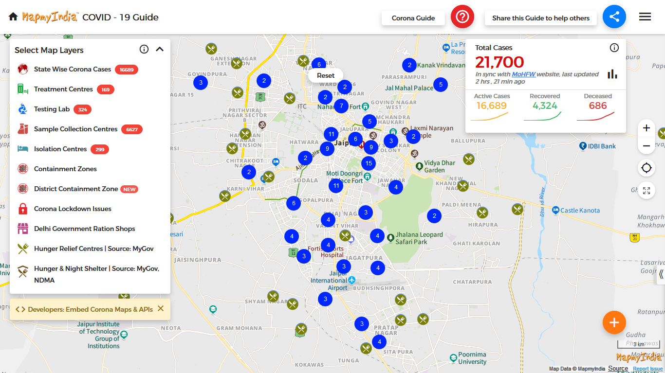
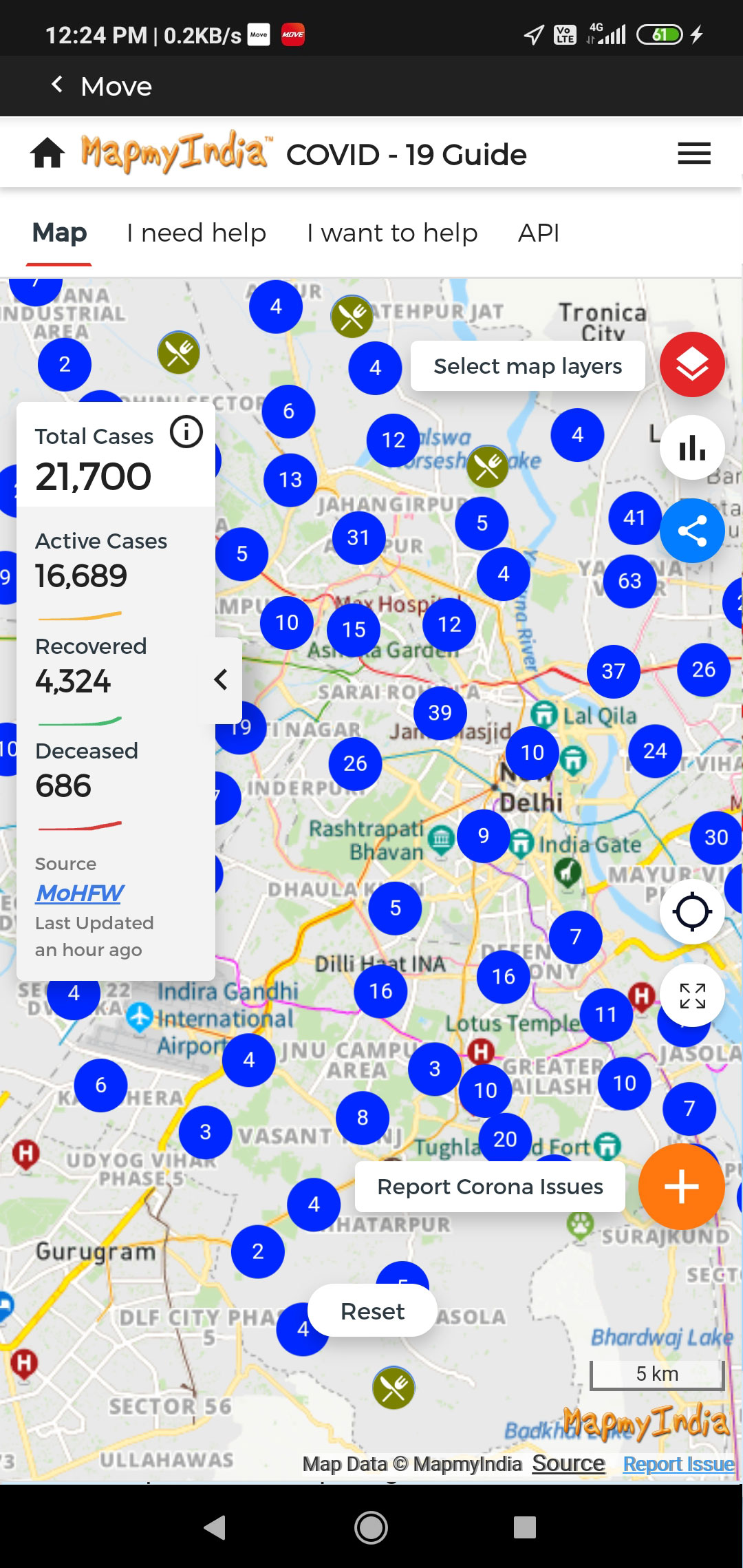
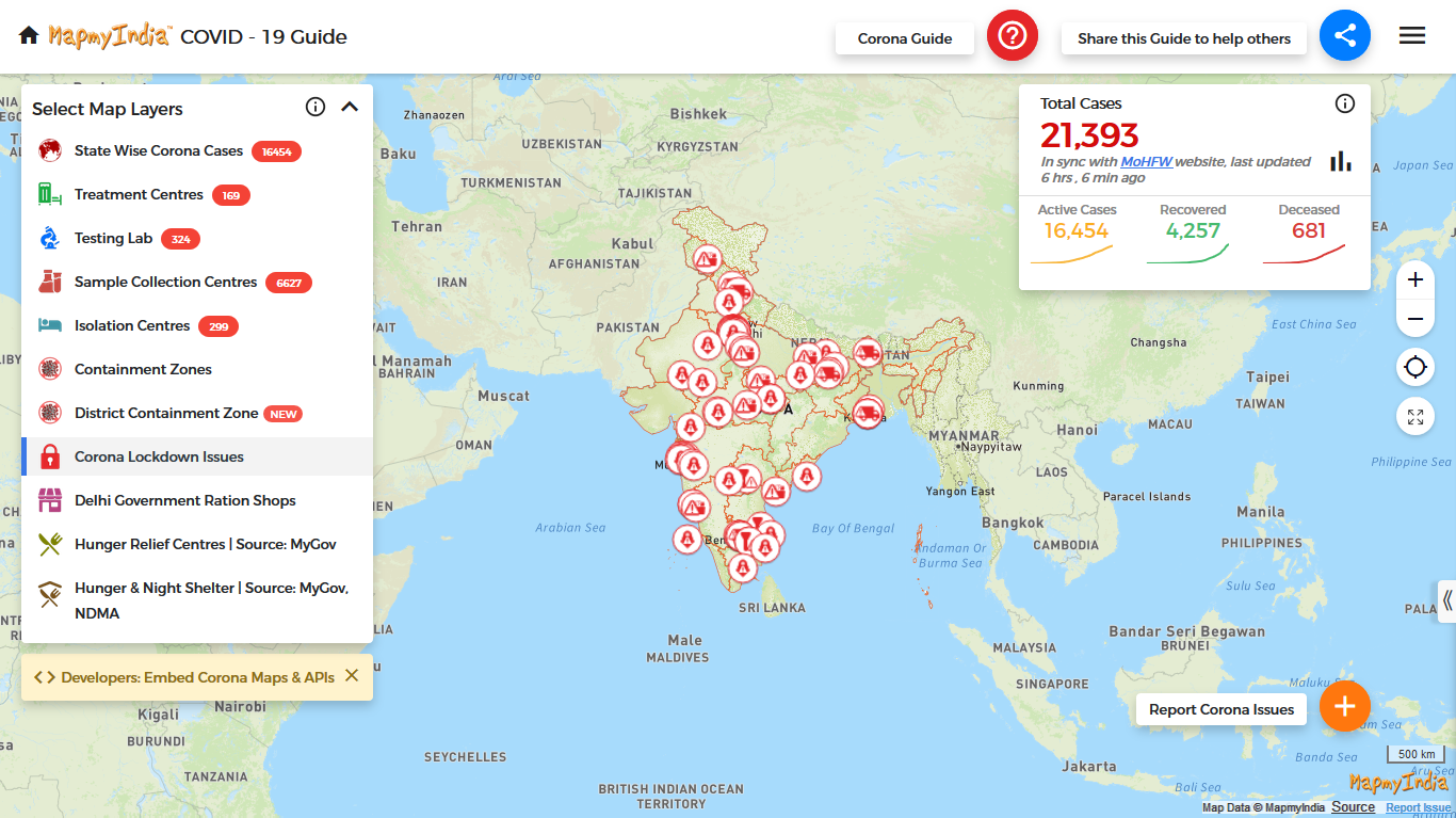
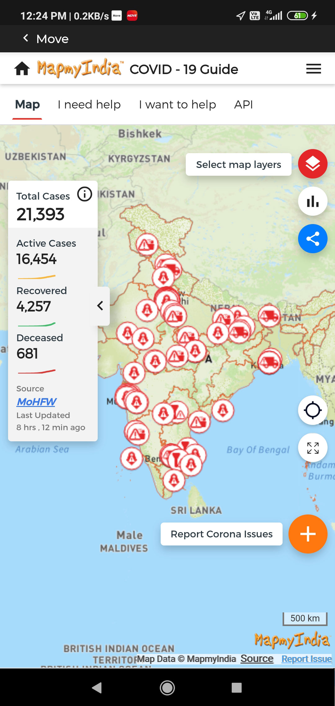
We at MapmyIndia are continuously updating the database of COVID-related places, such as vaccine centres, treatment centres/hospitals, containment zones, testing centres, isolation centres etc. This is the most comprehensive pan India covid related map database, and we've released it for free through our MapmyIndia Move app (mapmyindia.com/move) and MapmyIndia Maps portal (maps.mapmyindia.com) and MapmyIndia Corona guide (maps.mapmyindia.com/corona).
We're helping ANY website or app developer to easily integrate this information, as a FREE widget, for the benefit of your users and visitors.
The widget can be used to search for vaccination centres, testing centres, sample collection centres, treatment centres, quarantine centres and micro containment zones across India.
Inside the section of HTML of web page, define a div into which the nearby COVID places widget from MapmyIndia needs to be loaded.
<div id=“nearby-covid-places-mapmyindia”></div>
Inside the section of HTML of web page, or wherever else you find more suitable, include the following MapmyIndia javascript code.
<script src=“https://maps.mapmyindia.com/covid-places/showNearbyCovidPlacesOnMap.js”></script>
To load up the nearby COVID places widget from MapmyIndia, call the following javascript code AFTER the mapmyindia javascript file (as defined in step 2) has loaded.
loadNearbyCovidCentresMapmyIndiaDiv(document.getElementbyId(“nearby-covid-places-mapmyindia”));
That’s it - all done!
On reloading your web page after integrating the code -
loadNearbyCovidCentresMapmyIndiaDiv() Method
<html>
<head>
<!-- Include the following MapmyIndia javascript code into your webpage -->
<script src="https://maps.mapmyindia.com/covid-places/showNearbyCovidPlacesOnMap.js"></script>
</head>
<body>
<!-- define the div into which the nearby COVID places widget from MapmyIndia needs to be loaded -->
<div id="nearby-covid-places-mapmyindia"></div>
<!-- call the following code AFTER the mapmyindia javascript file has loaded -->
<script type="text/javascript">
loadNearbyCovidCentresMapmyIndiaDiv(document.getElementById("nearby-covid-places-mapmyindia"));
</script>
</body>
</html>
(change NOT recommended)
https://maps.mapmyindia.com/covid-places/css/custom.css
To be passed as
loadNearbyCovidCentresMapmyIndiaDiv(document.getElementById("nearby-covid-places-mapmyindia"),{css:"https://maps.mapmyindia.com/covid-places/css/custom.css"});
The Nearby COVID Places Widget already has the capabilities to search for not only nearby vaccination centres, but other important COVID places as well. To search for other categories of COVID places, a simple additional parameter in the script URL of the widget enables you to specify which category you want the widget to search for.
<script src="https://maps.mapmyindia.com/covid-places/showNearbyCovidPlacesOnMap.js?category=HSPTMT"></script>
<html>
<head>
<!-- Include the following MapmyIndia javascript code into your webpage -->
<script src="https://maps.mapmyindia.com/covid-places/showNearbyCovidPlacesOnMap.js?category=HSPTMT"></script>
</head>
<body><!-- define the div into which the nearby COVID places widget from MapmyIndia needs to be loaded -->
<div id="nearby-covid-places-mapmyindia"></div><!-- call the following code AFTER the mapmyindia javascript file has loaded -->
<script type="text/javascript">
loadNearbyCovidCentresMapmyIndiaDiv(document.getElementById("nearby-covid-places-mapmyindia"));
</script>
</body>
</html>
Read the following Wiki article to see more sample of how to search for other types of COVID places using the Nearby Search Widget.
The most important thing to remember while embedding this widget in an iFrame is that, an iFrame by default, does NOT allow for geolocation access. This means that the widget won't get the current location of the user of the web page to allow searching for COVID places near his location.
To overcome this, please ALWAYS add attribute of allowing geolocation in the iFrame tag as follows:
 <iframe width="100%" height="100%" src="https://maps.mapmyindia.com/covid-places/embed?category=HSPVCC" allow="geolocation" >
</iframe<
The same URL can also be used for Native WebView implmentation of the Nearby COVID Places Widget.
| Category Code | Description |
|---|---|
| HSPVCC | Corona Vaccination Centres |
| HSPTST | Corona Testing Centres |
| HSPTMT | Corona Treatment Centres |
| HSPCOV | Corona Quarantine Centre |
| HSPSCC | Corona Sample Collection Centre |
| CNTZON | Corona Micro Containment Zones |
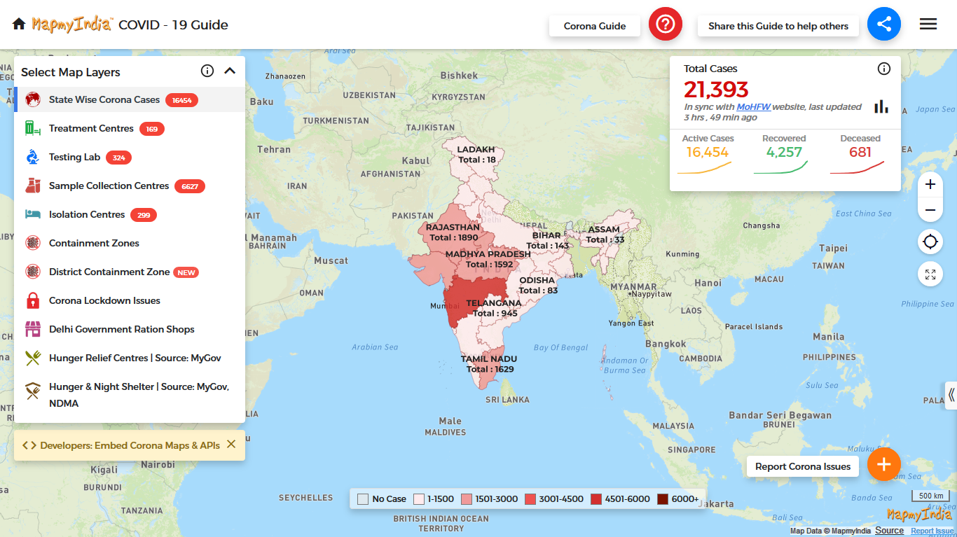
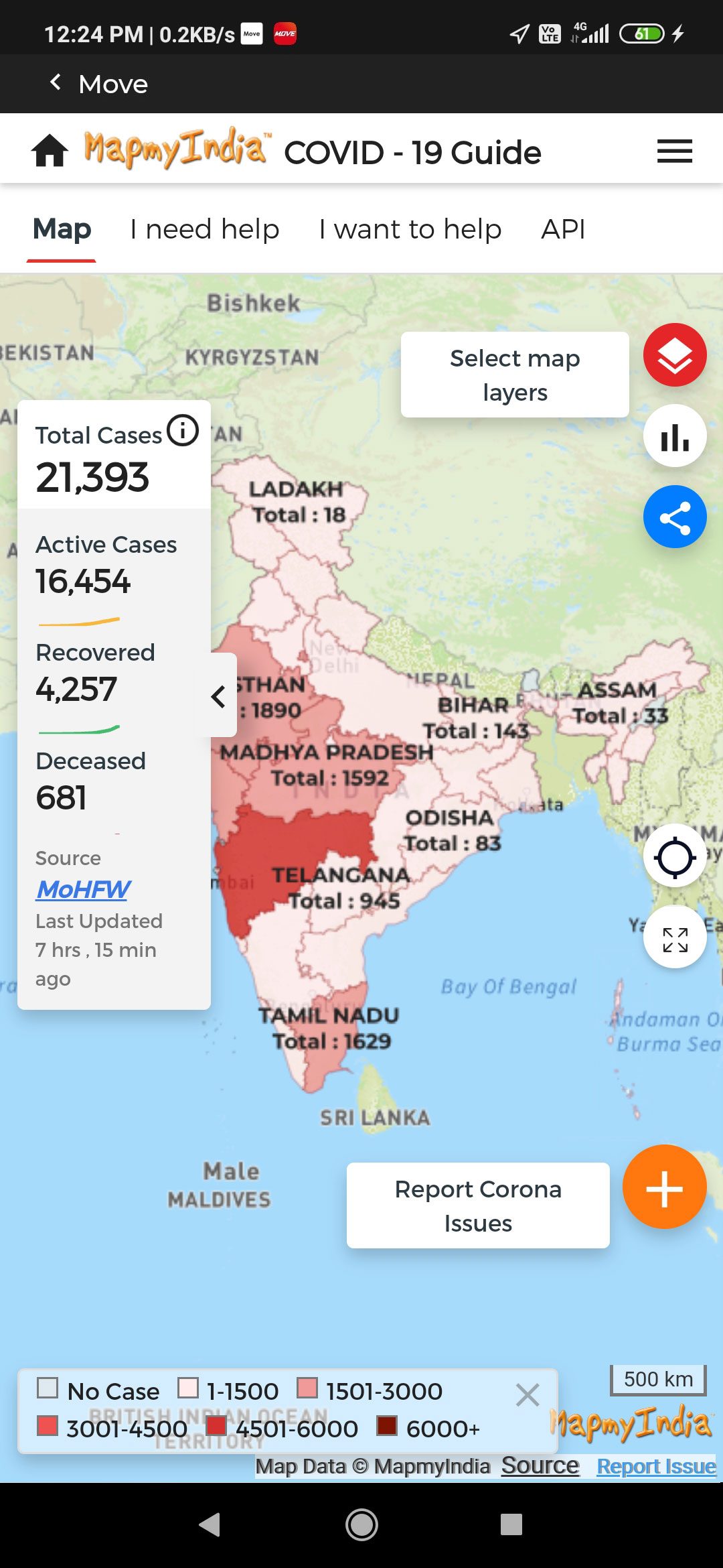
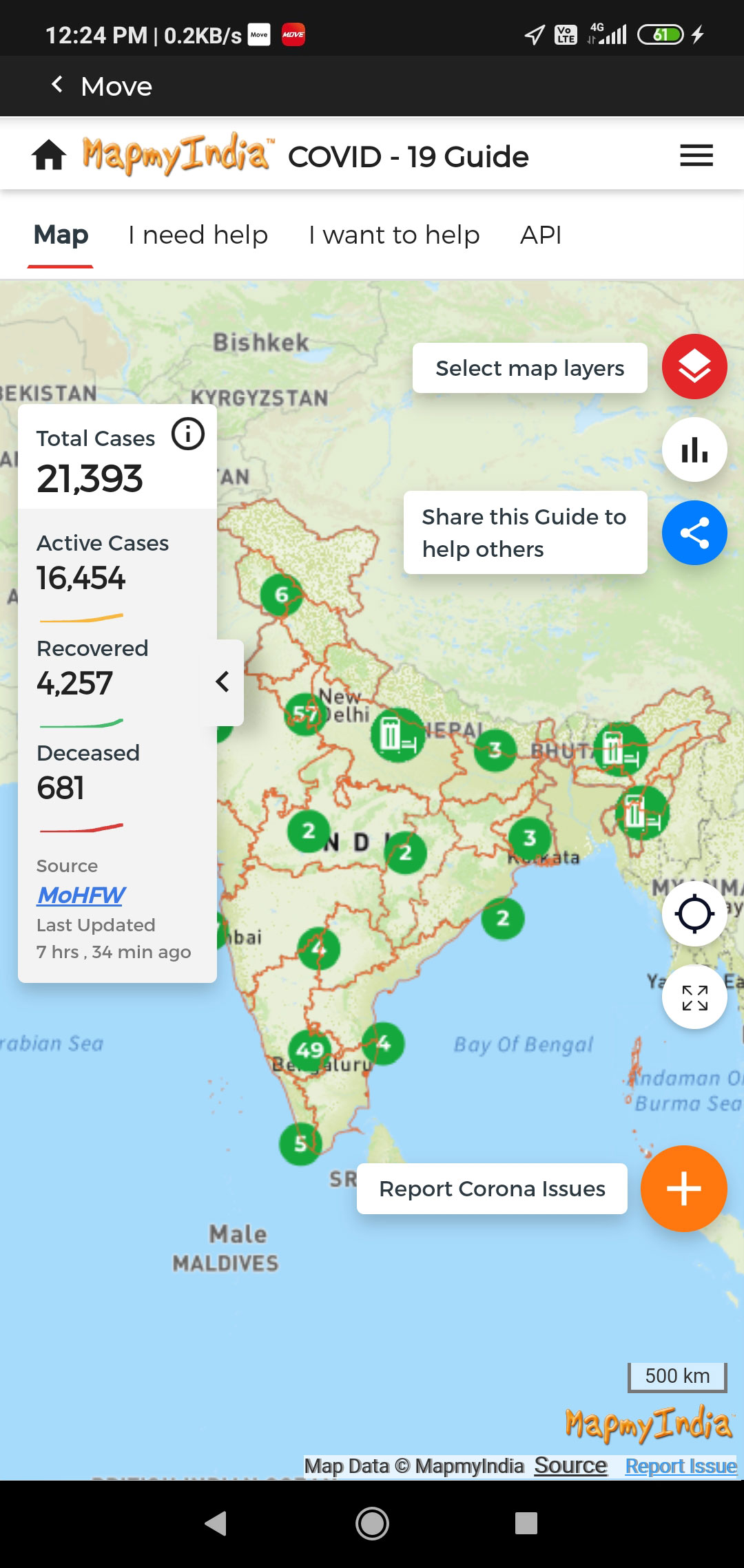
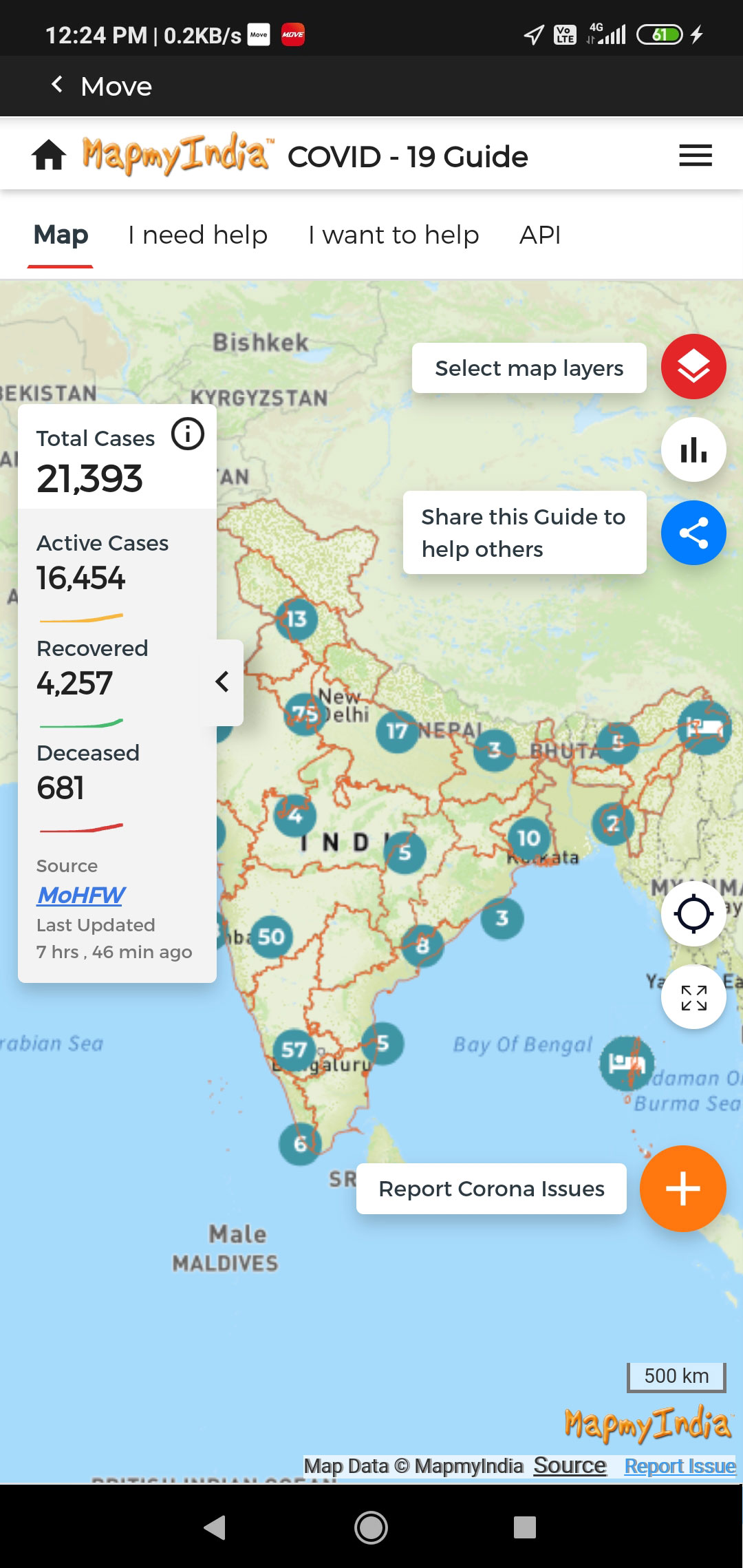
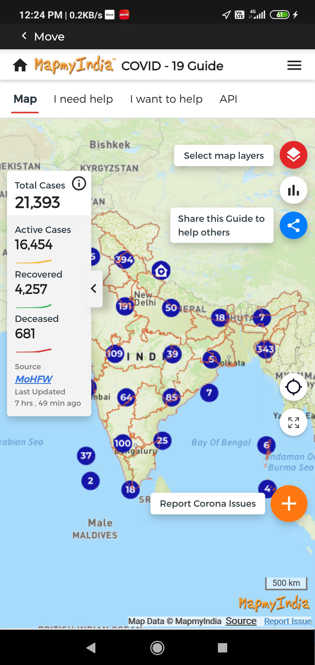
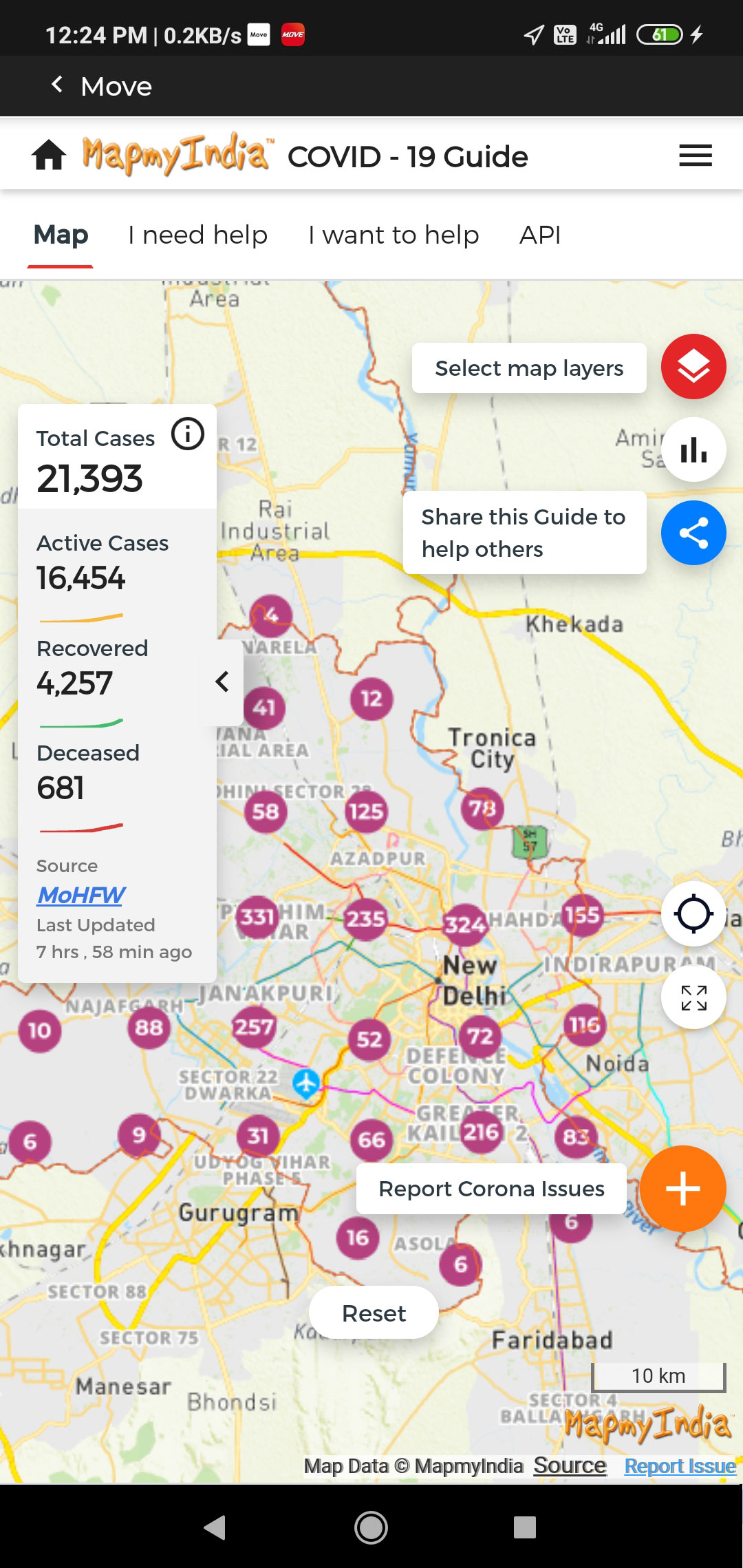
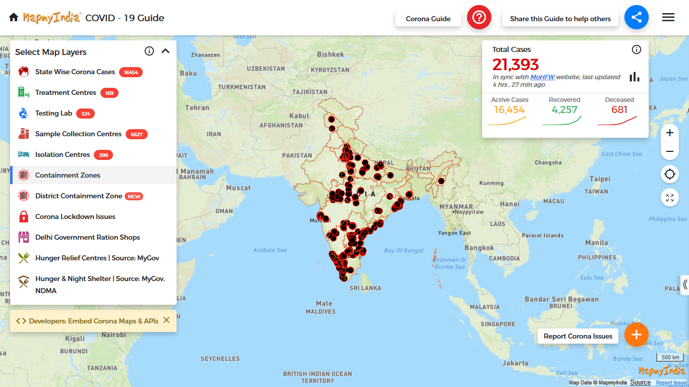
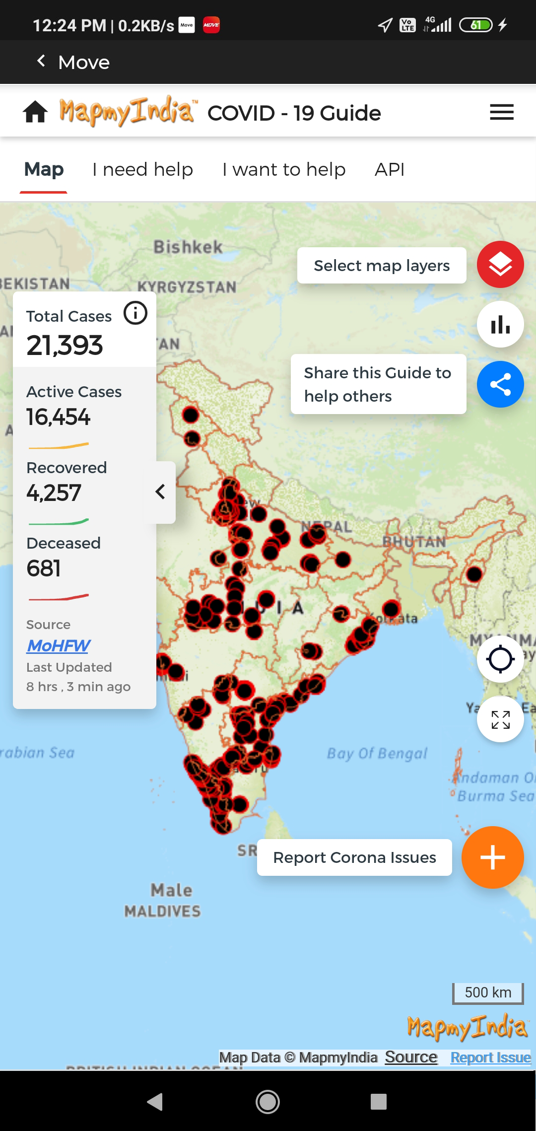
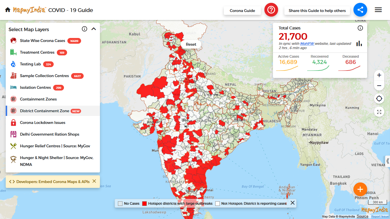
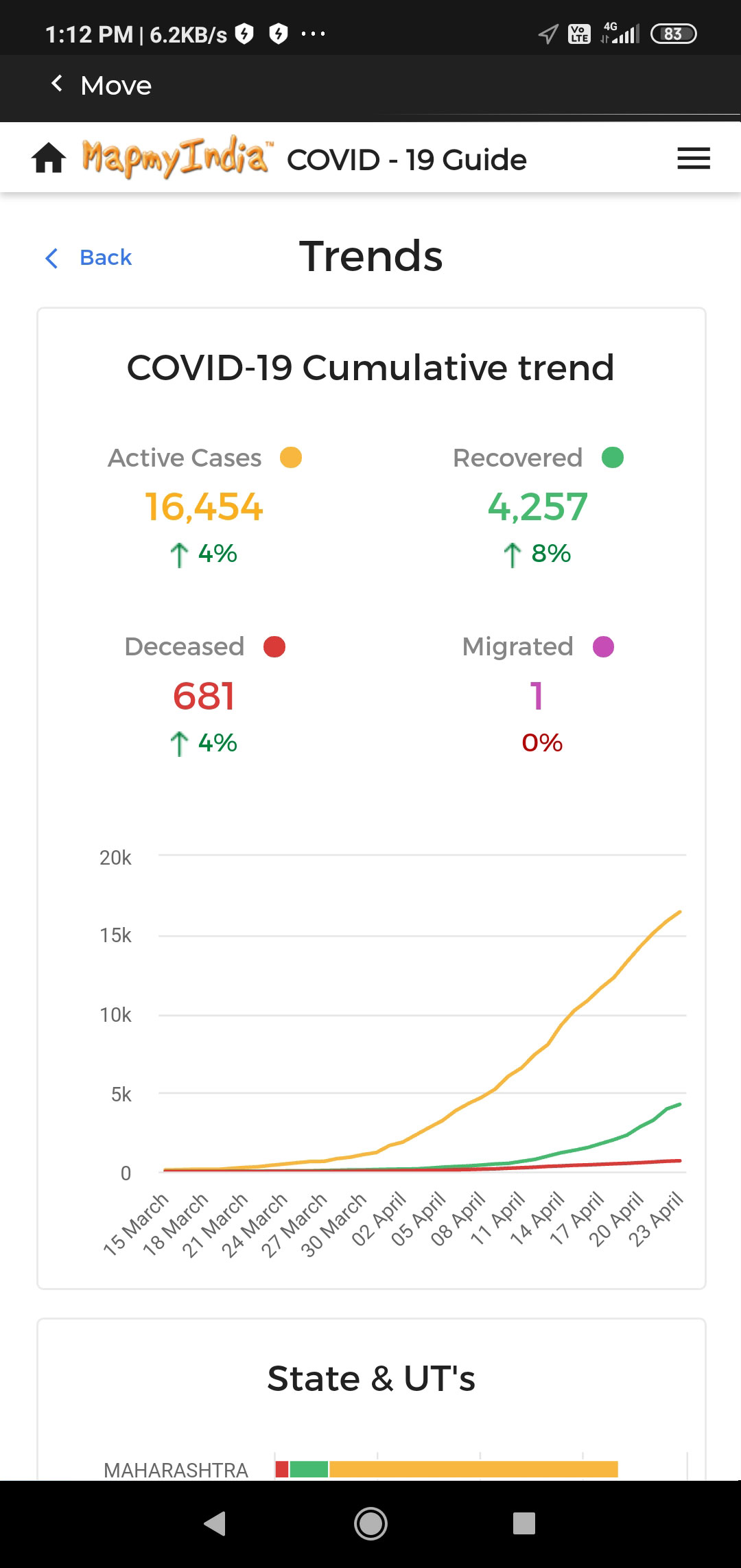
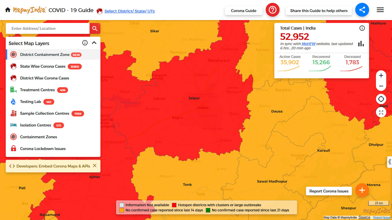
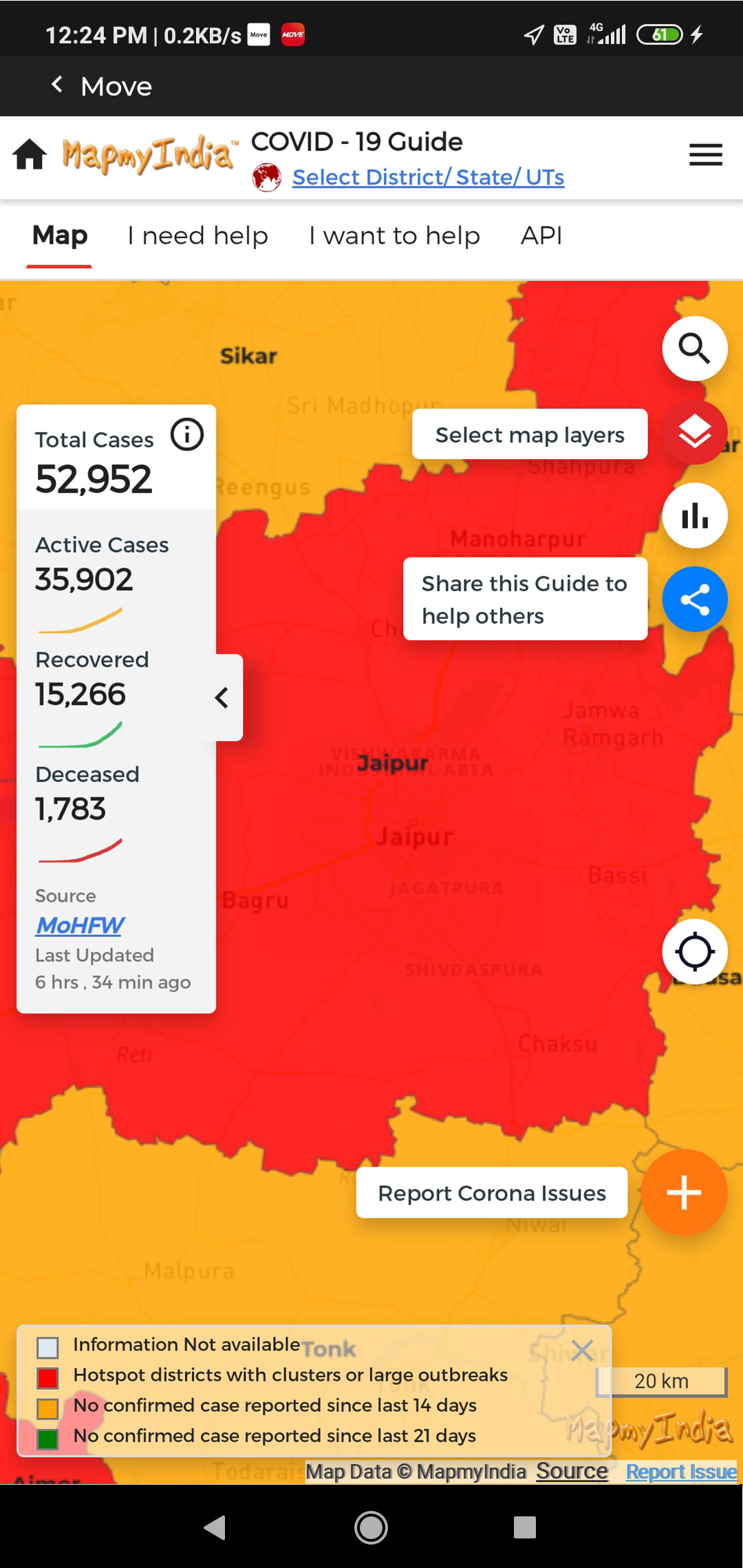
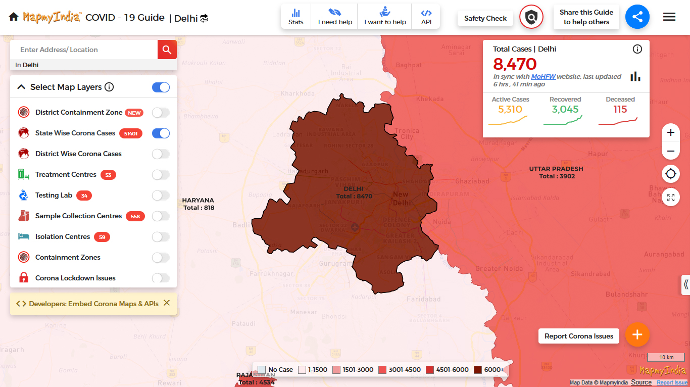
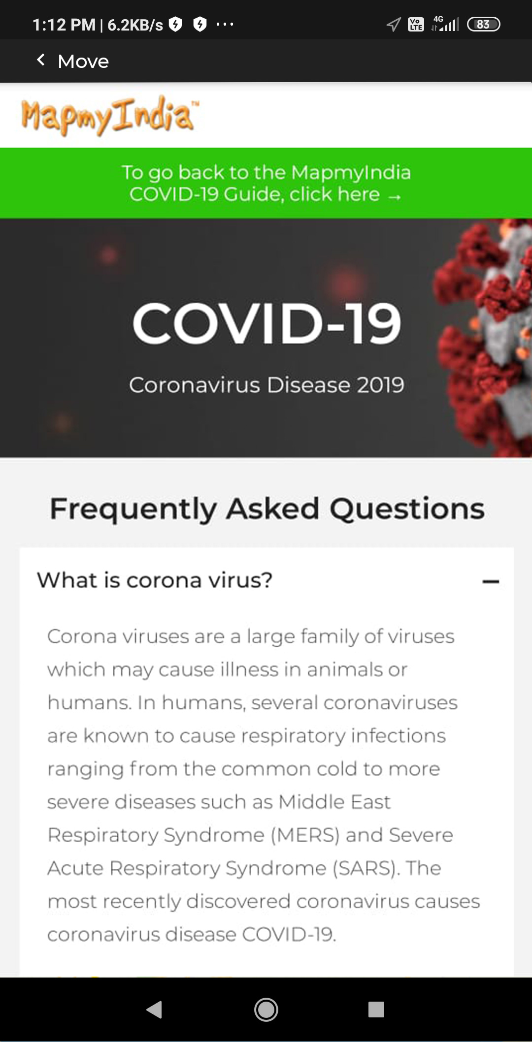
In the current scenario, where social distancing is paramount, technology is playing a key role in maintaining daily communication and information transfer. MapmyIndia is serving individuals, companies and the government alike, to spread critical information related to COVID-19 through deeply informative, useful and free-to-integrate geo-visualized COVID-19 dashboards, map search guides, and reporting tools, powered by Move.
Simply plug these easy-to-integrate and rich dashboards into your applications or websites, and offer a seamless information experience to your users. Join MapmyIndia's small contribution towards making a safe and informed India, and help alleviate everyone out of this unprecedented crisis.


All our dashboard URLs now accept values to be passed in two parameters - Lat/Long and Zoom Level.
Now, pass these two parameters in your calls to open custom views of the dashboards at a predefined location (lat/long) and zoom level of your choice.
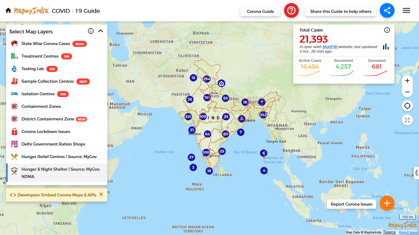
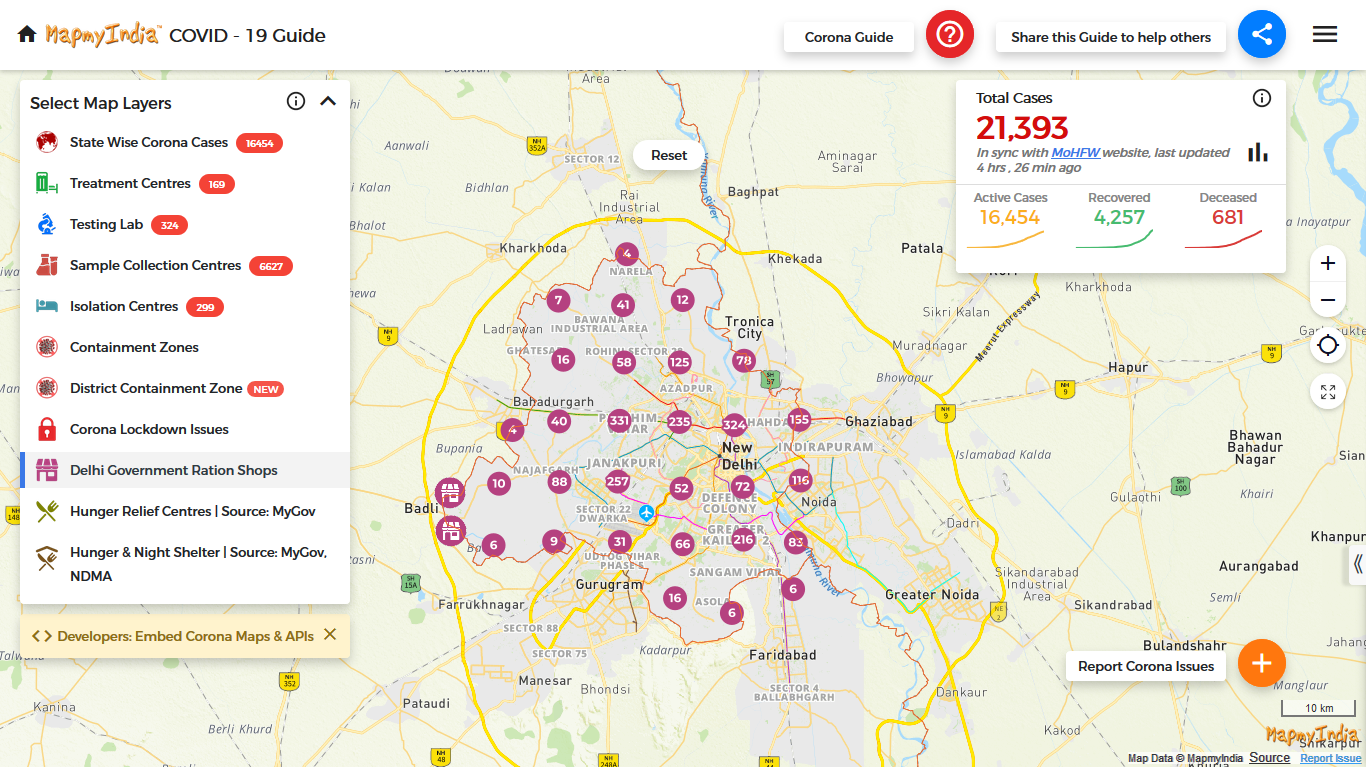
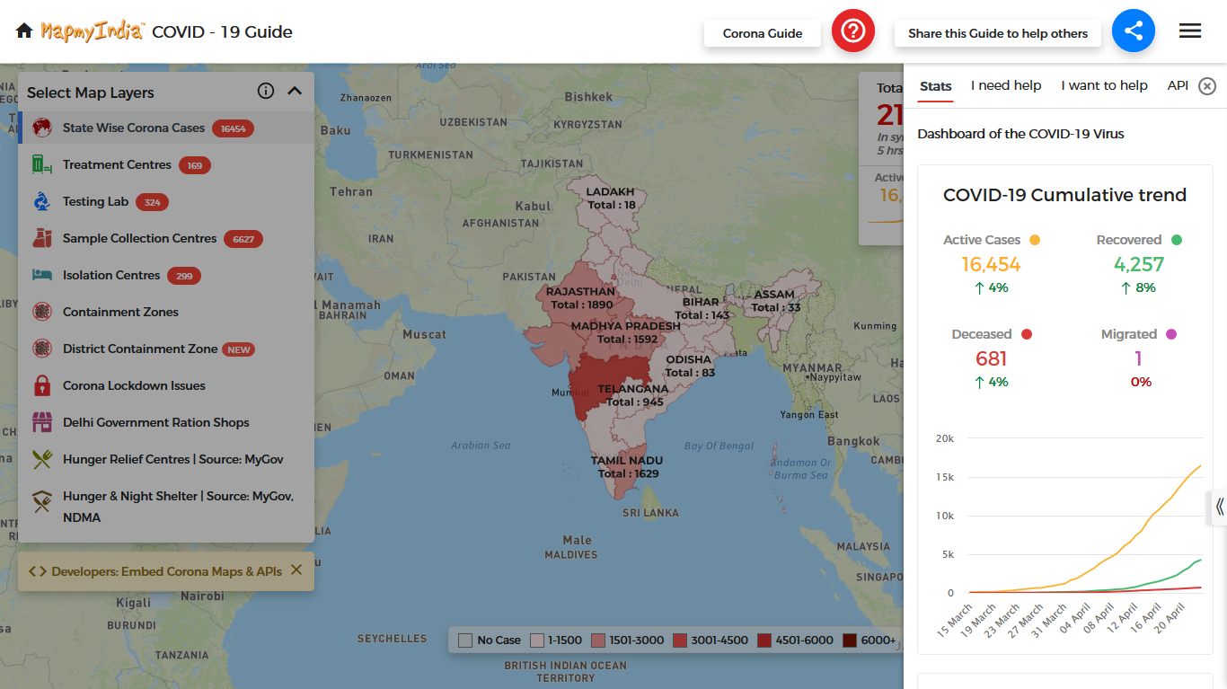
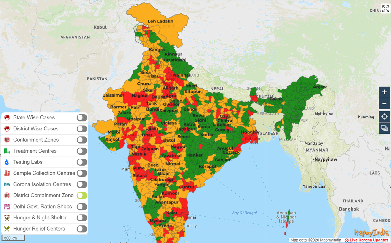
The new filter controls allow each Covid-19 layer available on MapmyIndia dashboard to be filtered to a more granular level till state/UT or district levels.
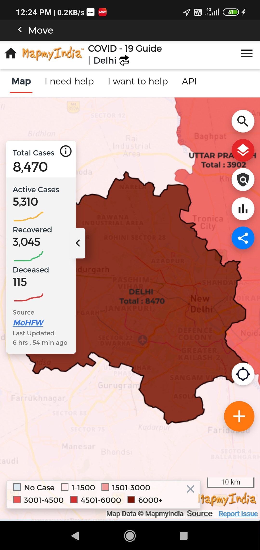
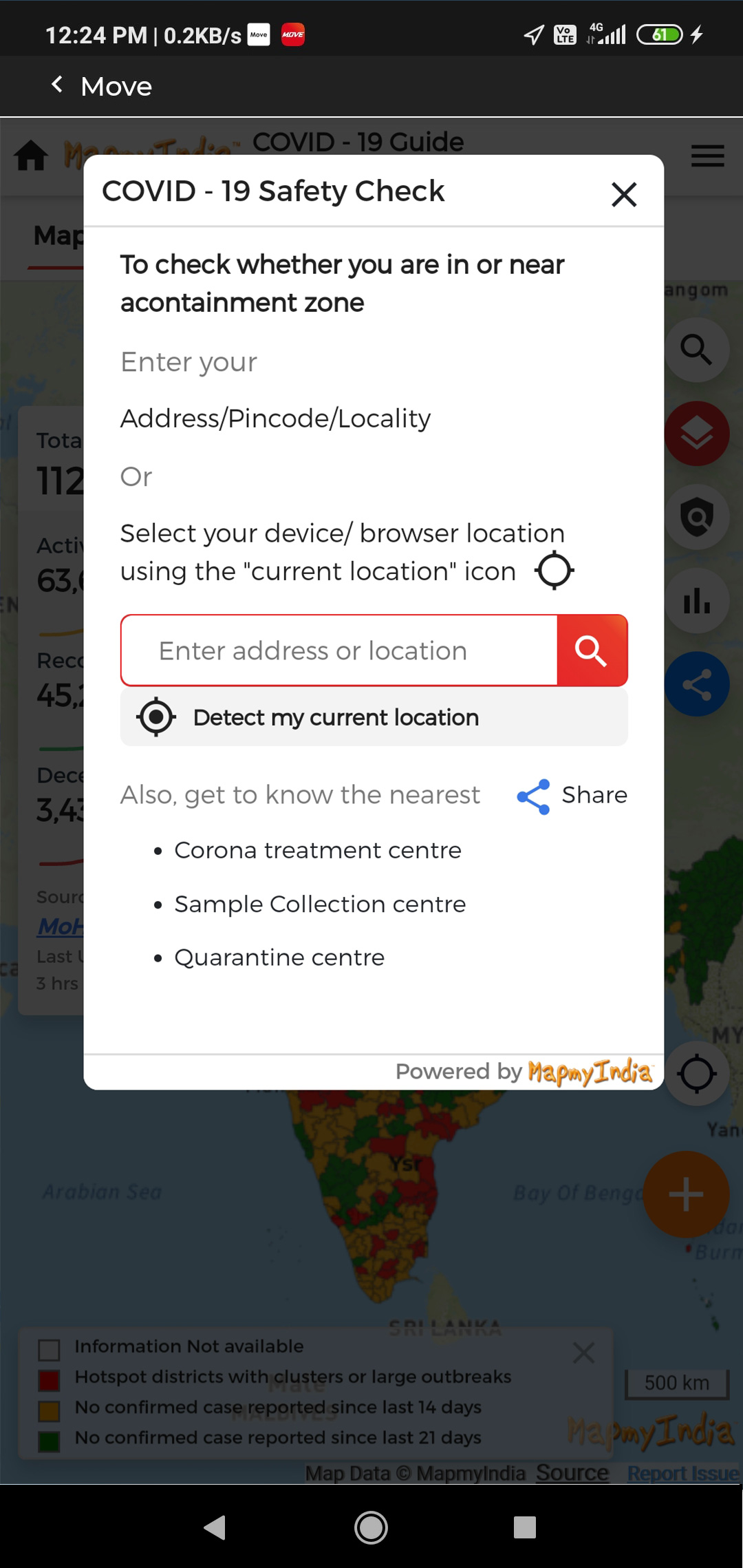
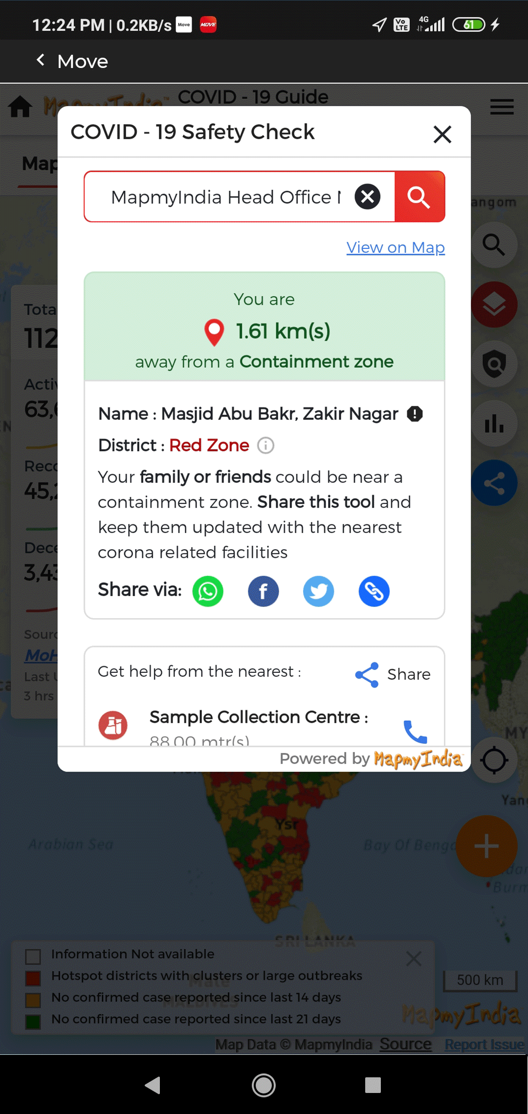
Find out how far you are from the nearest containment zone.
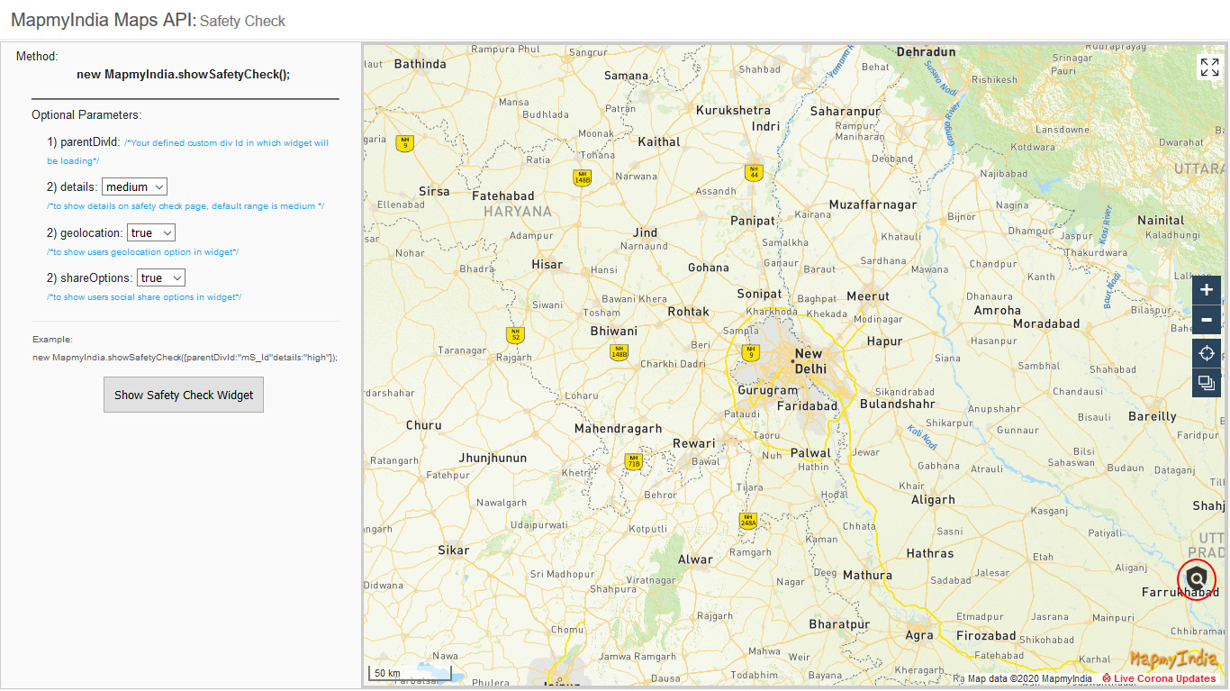
This plug-in allows one to render corona layers, being offered to customers as JS based plugin to overlay on top of MapmyIndia Raster Maps for Web.
The plugin is an integral part of our Maps SDK for Web and the base maps will always be MapmyIndia's if this plugin is used.
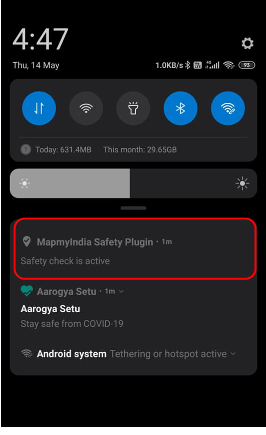
MapmyIndia Safety Plugin will alert when a user is in or near to a containment zone. If an app, with MapmyIndia Safety plugin integrated, is running on a phone, MapmyIndia Safety plugin will push a local notification when the user goes in or near to the containment zone, which can be seen from the notification panel.
MapmyIndia Safety Alert as a JS plugin for use with our Web SDK.
If you wish to use some other map APIs or want a customized solution, please check out


